The simulator screen
Two bars frame the radar. The top one tells you about the airport and opens panels; the bottom one controls what gets drawn.
Top bar
Section titled “Top bar”
- ICAO — the airport code.
- QNH — the current altimeter setting. This is the number you pass to pilots.
- TL — the transition level.
- RWY — the arrival and departure runways in use.
- COM — recognised text, clearances and pilot readbacks.
- TFC — the selected aircraft’s flight strip.
- CLOCK — the draggable simulation clock.
- SETTINGS — the six settings tabs.
The COM panel shows one natural YOU line for each instruction you send, followed by the pilot’s response under its callsign. Internal command names and procedure codes do not appear there. If voice recognition fails, one HEARD line shows what the game understood and a SYS line explains what to repeat.
Not in 0.6.1.24Bottom bar
Section titled “Bottom bar”
MAPS — navigation and background
Section titled “MAPS — navigation and background”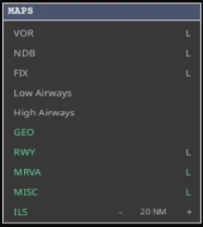
VORs, NDBs, fixes, low and high airways, geography, runways, minimum vectoring altitudes and miscellaneous drawings. L shows labels for the layers that have them. ILS draws localizer centrelines, and its own control sets the drawn range in nautical miles. Geography stays continuous and readable while you zoom. Minimum-vectoring-altitude boundaries use their correct display thickness as soon as the radar opens. Not in 0.6.1.24
Use GEO to switch all environmental geography on or off. Its + menu lets you control COASTLINES, LAKES and RIVERS separately. All three start on, each choice is remembered, and major rivers include the Potomac used as context for Washington’s visual approaches. Not in 0.6.1.24
PROCS — procedures
Section titled “PROCS — procedures”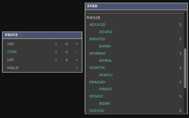
SIDs, STARs, approaches and holding patterns. L adds waypoint labels, A adds altitude constraints, and + lets you pick individual procedures and transitions rather than all of them.
Inside +, SID and STAR rows carry a second button, S. The name decides what the radar draws; S decides whether generated traffic may be given that procedure. The two are independent.
- Approach rows carry S as well.
- Named visual rows appear under IAP for drawing only. They have no S button and cannot be assigned to generated traffic from this menu.
- Where community data curates an airport’s spawn picks, the popup says whose picks are in force and switches between the community’s and your own.
AIRSPACES — boundaries
Section titled “AIRSPACES — boundaries”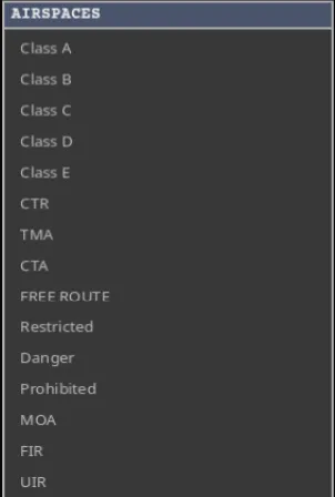
ICAO classes, CTR, TMA and CTA, free-route airspace, restricted, danger, prohibited and military areas, and FIR and UIR boundaries. Radar coverage radii are calculated automatically; there is no manual radius control.
Not in 0.6.1.24Your selections in MAPS, PROCS and AIRSPACES stay saved for each airport setup. Not in 0.6.1.24
TAG, range, prediction, speed and cleanup
Section titled “TAG, range, prediction, speed and cleanup”- TAG — automatic label placement, which spreads labels to stop them overlapping. Turn it off to place them yourself with right-drag.
- NM — the radar range across your screen. − tightens the view and + widens it, around the radar centre, through the same limits and scale path as the mouse wheel. The readout follows the mouse wheel too. Not in 0.6.1.24
- v — how many minutes ahead each prediction line reaches: v0, v1, v2, v4, v8.
- x — simulation speed, x1 to x64. Every session starts at x1, and pausing does not forget your choice.
- CLR QDM — removes every QDM measuring line, including one you are drawing.
- CLR ROUTES — removes every orange TAB route preview.
The two clear buttons are independent, change no clearance or guidance, and are safe to press when nothing is drawn.
When you enable Multi QDM, each completed line stays on the radar so you can start another. Turning it on after a normal QDM keeps that line as the first measurement.
TFC — the flight strip
Section titled “TFC — the flight strip”The TFC panel is a movable strip showing one aircraft in full. Click a target to fill it; it follows that aircraft until you select another.
| Field | Meaning |
|---|---|
| Callsign | The flight’s radio identity. |
| Airline | Operator name or three-letter code. |
| Departure / arrival | Origin and destination ICAO codes. |
| Flight rules | Normally IFR. |
| Cruise level | Planned cruise flight level, such as F360. |
| Aircraft type | The model, such as A320. |
| Wake category | Heavy, Medium or Light. |
| Squawk | The four-digit transponder code. |
| Route | The real en-route routing. |
| Cleared waypoint | The current direct-to or guidance target. |
Generated traffic reuses real route or airline callsign patterns when they are available. Without either sample, it uses a four-digit flight number.
The route field leaves out the departure and arrival airports. When a route is too long to fit, arrivals keep the destination end and departures keep the origin end — the part you are about to deal with.
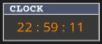
Local simulation time in hours, minutes and seconds. The prediction and game-speed controls are in the bottom bar, not here.
Alerts
Section titled “Alerts”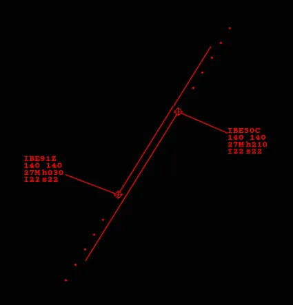
A CA warns that two aircraft are getting too close. Check both, then change a heading, altitude or speed to restore the gap.
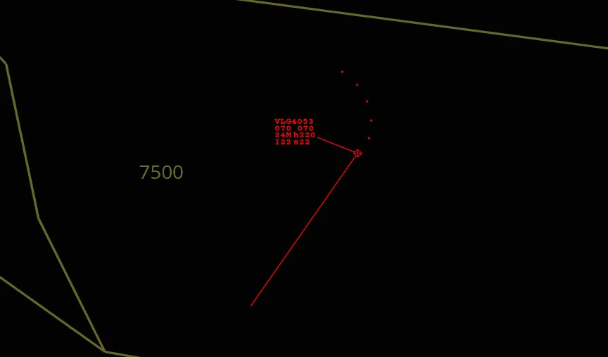
An MVA warning means an aircraft is below — or cleared below — the safe vectoring altitude for that area. Climb it, or put it back on a published procedure that provides its own terrain protection.
Two panels for planning ahead
Section titled “Two panels for planning ahead”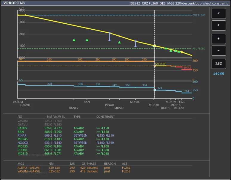
Shift+V opens the vertical profile: flown history, planned altitude and speed, top of climb, top of descent, deceleration point and published restrictions. Use −, +, the arrows and Reset to move around it.
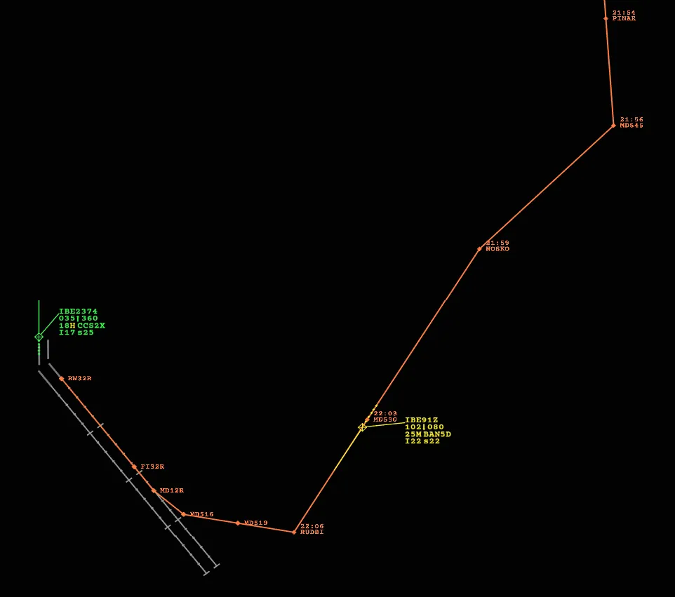
TAB shows the selected aircraft’s route with estimated times and constraints; press it again to hide it. Named SID climbs and vector discontinuities stay visible as breaks rather than being smoothed over. An open preview refreshes when you change the route or approach, but stays on screen independently of the clearance — CLR ROUTES clears them all.